Bringing HOPE to the people of HAWSTON

A project of the Hawston Community in partnership with FCR, Arabella, local and Provincial Government


Home  
Caravan Park  
Restaurant  
Photo Gallery  
Links  
Route Map  
Development Project  


- Components  
  - Board Members  
  - Media Reports  
  - Our Partners  
  - Become Involved  
  - Company Details  


ROUTE MAP


Hawston is a small fishing village in the Overberg Region of the Western Cape. Hawston lies within the Greater Hermanus area and is serviced by the Overstrand Municipality. It is located approximately one hours drive from Cape Town across the Hottentots Holland Mountains.


Map Copyright © 2003 MAX Internet Technologies CC
t/a MAXITEC.  All rights reserved


HOW TO GET THERE


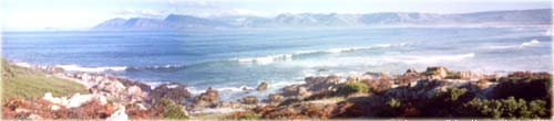
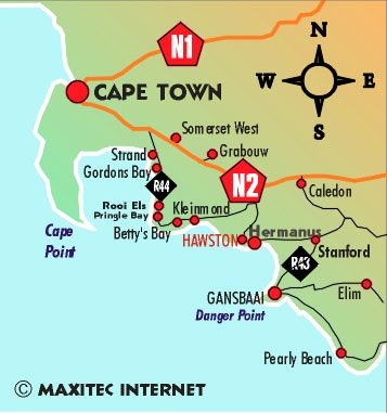
Hawston is on the coastal side of the R43 between Fisherhaven and Hermanus.

From Cape Town, take the coastal-route to Kleinmond, take the R44 past Kleinmond, turn right onto the R43 towards Hermanus. Hawston is approximately 5Km after the turn-off.

From Cape Town or the north, drive on the N2 up to Botriver, take the R44 turn-off towards Kleinmond. Turn left on the R43 towards Hermanus. Hawston is approximately 5 km after the turn-off.

From Caledon, take the R320 to Hermanus. Drive through Hermanus to Hawston, approximately 3km from the town.


Website Developed & Hosted by MAXITEC Internet
Copyright © 2003. All rights reserved.